Geographic
Advertisement

GeoNetwork - Geographic Metadata Catalog v.2.6.4.0
A web based Geographic Metadata Catalog for data description and discovery.
Advertisement
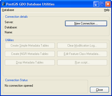
PostGIS GDO v.1.0.1.2
PostGIS data server is a GDO (Geographic Database Object) component that enables read and write to a Postgre/PostGIS database from Intergraph GeoMedia product family.
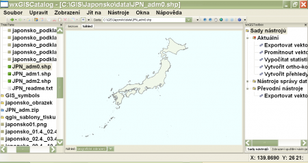
WxGIS Portable v.0.4.1
wxGIS is a useful application that allows you to manage and to organize multiple types of geographic information.

Thuban for Linux v.1.2.2
Thuban is an interactive geographic data viewer (GIS viewer) which features methods to visualize, explore, and analyze geographic information.
Thuban for Mac OS X 1.0.1-3 v.3
Thuban is an interactive geographic data viewer (GIS viewer) which features methods to visualize, explore, and analyze geographic information.
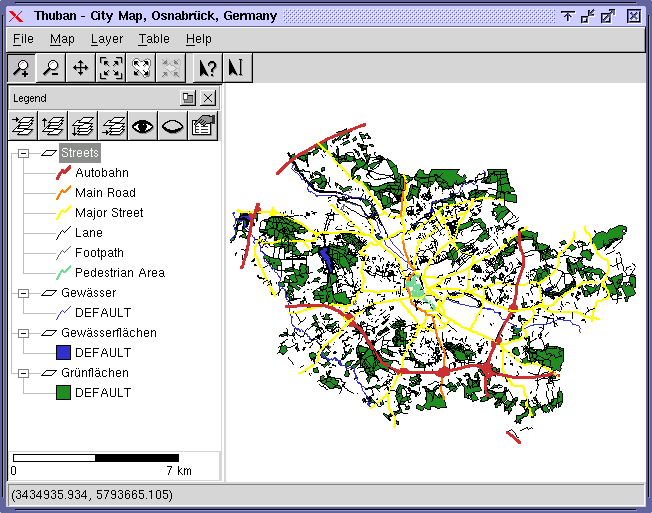
Thuban for Windows v.1.2.2
Thuban is an interactive geographic data viewer (GIS viewer) which features methods to visualize, explore, and analyze geographic information.
TmsINTRANET
tmsINTRANET is a web-based application that facilitates communication, business processes and collaboration among employees and partners from different geographic locations. It is easy to use Takes only minutes to implement
Geodaten International Admin
Geo data international world-wide with towns, town quarters and postal codes. Georeferences as UTM- and geographic coordinates (WGS84) and elevations. Suitable for branch searches, periphery searches and distance computations. Australia, Austria,
ImageVisu v.4.0.2
ImageVisu is a simple and powerful image and graphics viewer. - It can display files from the Web (HTTP and ECWP). - It has a slideshow mode. - In addition to well-known image formats, it displays geographic and GPS files.
GsT HOMER v.1. 2. 2000
The Geospatial Toolkit (GsT) is an NREL-developed map-based software application that integrates resource data and other geographic information systems .
GeoVISTAStudio v.7.0
GeoVISTA Studio is an open software development environment designed for geospatial data. Studio is a programming-free environment that allows users to quickly build applications for geocomputation and geographic visualization.